
I still have nightmares about a guy who came to City Hall and talked about floods. He worked for the Sacramento Area Flood Control Agency and spoke words that terrified me.
Growing up in Sacramento, I knew about floods and the dangers they presented. Thankfully, those dangers were always theoretical or viewed from safe distance.
When big floods came they inundated Peach Tree Mall in Yuba County. Or they swamped roadways and overflowed canals in rural areas such as Wilton or Arcade or Dry Creek. That’s what I knew.
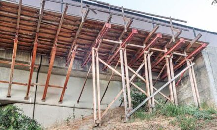
Floods didn’t happen in Sacramento, at least not anymore. A system of dams, weirs and levees guarded the city. The last time rowboats floated on Downtown streets was 1862, when a levee broke near today’s River Park and flooded the town.
Authorities didn’t mess around back then. They took the American River and moved it. They jacked up city streets by 14 feet. No more floods in the grid.
The flood control guy at City Hall changed my outlook. I worked for the city in those days. My sense of flood protection was based on levee integrity and drainage systems. As long as the levees held, no problem.
Not true, the flood man said. There was another worry that haunted pros who guide water around California.
The fear involves three elements: a massive snowpack in the Sierra Nevada, unseasonably warm weather in March, and a week of relentless springtime rain.
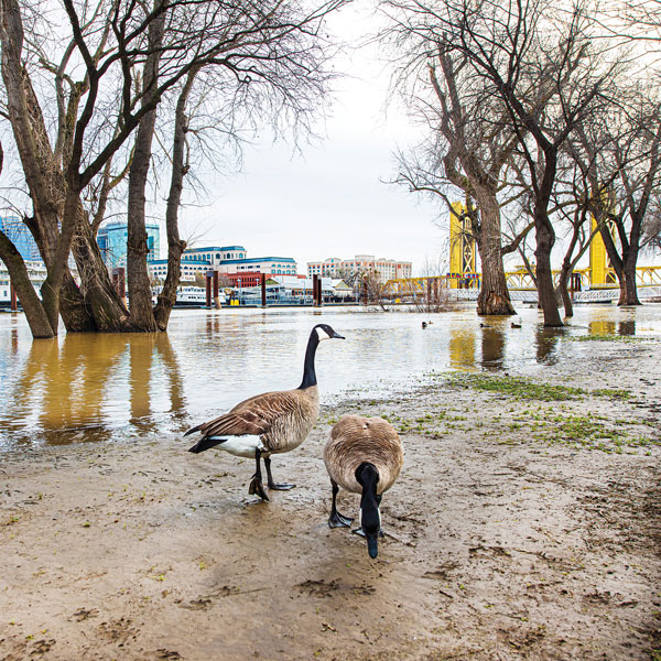
These three events can trigger a devastating chain reaction. As we saw in January, water management teams work hard to manipulate releases into the American and Sacramento rivers. But if there’s too much water, options evaporate.
Water is simple. It goes downhill. With too much water, at some point management becomes impossible. Rivers rise. Levees overflow. Even if levees hold, there’s a limit to their capacity.
The flood guy explained why Folsom Dam required expansion: to hold more water upstream during a spring runoff. Now I worry about snowpacks and warm spring rains.
Fortunately, the city recognizes this and publishes maps to project what happens if Sacramento floods. The maps are designed to prepare residents for a catastrophic flood emergency. Maybe you looked at the maps in January. If not, you should.
The maps show potential water depths in different parts of town. They show roads that serve as evacuation routes. They show how many days or hours will pass before those roads fill with water.
The maps don’t offer any comfort to residents in Pocket, Greenhaven, Little Pocket, Land Park and Downtown. The numbers are based on fiction, a hypothetical levee break at Broadway and Second Street. They imagine a horror story that could instantly move from fiction to reality.
Within two hours, Interstate 5 will be impassable from Downtown to Sutterville Road. Same with Riverside Boulevard and parts of Land Park Drive. The only open path out of town is Highway 99, but getting there isn’t easy. After seven days, Land Park is way underwater, anywhere from 8 to 16 feet. Or deeper.
The outlook is no better for Pocket residents. The worst color on the maps is purple, which indicates water depths of 16 feet or more after seven days. About 80 percent of Pocket and Greenhaven are purple.
Ironically, the safest spots are nearest the levee, where ground is higher. Pocket is a sink without a drain in the middle.
Evacuating a sink is a nightmare. City maps show Pocket exit routes where you would expect, along Florin Road, Pocket Road and Meadowview Road. But the city warns those streets will be impassable within two days of the mythical Broadway levee break.
Florin Road, running down the middle of the sink, will be too deep to cross within 24 hours.
As noted, the Broadway levee break is hypothetical. It could happen anywhere. Or the levees could overflow. Either way, my advice is pay attention to the Sierra snowpack. Remember what happened in January. Pray for a cool spring with little rain.
R.E. Graswich can be reached at regraswich@icloud.com. Follow us on Facebook, Twitter and Instagram: @insidesacramento.